On the 2021 Dixie Fire, HELCO was watching our mapping flight’s live feed on an iPad: AI-generated fire polygons from an Overwatch TK-7, full-motion thermal IR, and map overlays updated in near real time. As our Turbine Commander flew mapping lines at 22,000 ft, he spotted a new sparkle across his line and he texted a request for a closer look.
FireView™ app live intel from aircraft above
We kept to the mapping mission, and in parallel, zoomed the gimbal to his possible spot fire. Each time our flight line brought us near the area, the HELCO saw FMV close-ups streamed to his cockpit. Within minutes, he assigned a helitanker directly to the now confirmed spot, and it was knocked down before our mapping run ended.
Courtney Aviation’s core mission hasn’t changed: FireView™ compresses the time between detection → confirmation → tasking. Time is the difference between a manageable spot and a problem.
What is FireView™ Re-invented:
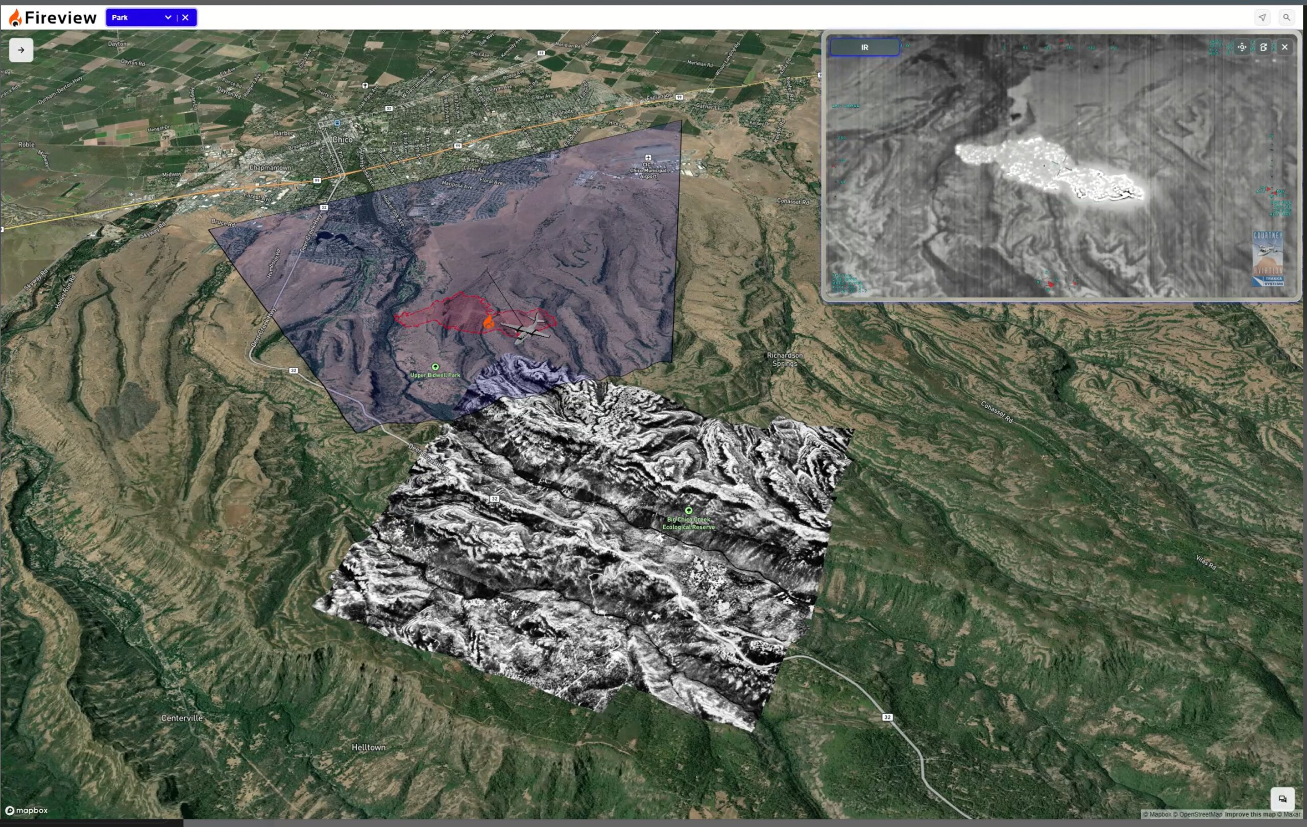
- Sensors: Overwatch TK-8 paired with a Trakka TC-300 zoomable RGB and MWIR gimbal.
- Connectivity: Airborne Starlink streams FMV, AI polygons, and thermal IR with ubiquitous coverage, stability, and faster setup.
- Delivery: FireView™ is built for approved incident personnel to intuitively use on phones, tablets, or PCs. Near real-time intel from capture to Incident Command creates Shared Situational Awareness (SSA) across the fire.
Incident crews get actionable, accurate, live intel: incident map context, perimeters, hot spots, and FMV confirmation to allocate air and ground resources with confidence, faster and more accurately.
Come see how air-to-ground interaction has been re-invented.
We’ll be demoing FireView™ at the Red Sky FireTech Showcase on November 4 in San Francisco. Come put hands on the viewer and watch thermal/RGB FMV and AI polygons flow into the app.