AERO FIRE INTELLIGENCE BLOG
100% Contained Wildfires Don’t Always Mean Safe
Rekindles are tragedies that haunt firefighters. The Palisades Fire killed 12 people, destroyed 6,873 structures, and cost roughly $200 billion. Maui’s disaster took 102 lives, burned 2,200 structures, and generated $3.8 billion in insurance claims. The Oakland Hills...
FireView Intel Viewer Re-invented. Courtney Aviation is showing a Fire Intel Demo at the Red Sky FireTech Showcase — November 4, San Francisco
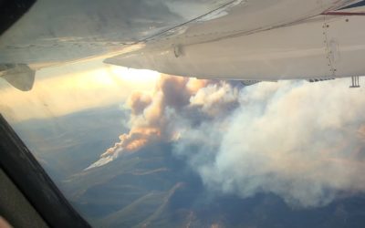
On the 2021 Dixie Fire, HELCO was watching our mapping flight’s live feed on an iPad: AI-generated fire polygons from an Overwatch TK-7, full-motion thermal IR, and map overlays updated in near real time. As our Turbine Commander...
Columbia Airport Celebrates 90 years of operation!
Courtney Aviation was proud to be a part of the community event celebrating the history and importance of our airport buried in the heart of gold country. It was a beautiful morning to enjoy food and drinks from our local vendors and learn about all the businesses and...
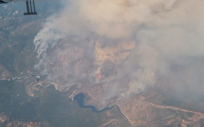
Mosquito Incident – September 6, 2022
The Mosquito Fire was active for just 50 just days in Placer and El Dorado Counties, burning a total of 76,788 acres. The incident destroyed 78 structures and damaged 13 more.
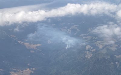
Mill and Mountain Incidents – September 2, 2022
The Mill Fire was active for 11 days burning 3,935 acres, destroying 118 structures and killing two people.
The Mountain Fire was active for 103 days burning 13,440 acres and destroying 4 structures, no one was killed during this incident.
Six Rivers Complex – August 5, 2022
The Six Rivers Lightning Complex was active for 88 days in Humboldt and Trinity Counties. This fire burned a total of 27, 019 acres, destroying 8 structures and injuring 5 firefighters.
Contact Courtney Aviation
We are based in Columbia, California, northwest of Yosemite National Park. Please call or email us with your questions, or to connect with one of our staff.
Courtney Aviation
10000 Technology Dr
Columbia, CA 95310