Wildland Fire Aviation Services
Wildland Fire Aviation Services
EXPERIENCED elite air attack services
High visibility Aero Commanders exceed Type 1 Air Attack specs.Intuitive tactical infrared along with highly trained pilots provide exceptional situational awareness, reduced workload, and increased mission effectiveness.
INFRARED DATA intelligence
Multiple infrared sensors aboard aircraft maximize effective operations, real-time products, and detailed accurate heat maps. MANET Mesh, FirstNet/ATT/Verizon cellular, and Satellite deliver live intelligence to the ground.
EXCLUSIVE USE LEASED AIRCRAFT FLEET
Six Aero Commanders and support aircraft are locked into exclusive operation and maintained above the highest FAA and fire agency standards. Human factors considered for simple effective operation and comfort during long flight missions.
IN-HOUSE PROFESSIONAL aircraft maintenance
Experienced mechanics, extensive hangars and equipment, mobile support vehicles, and mechanic’s planes allow for fast service in the field. Staff, equipment, & spare parts enable turbine engines to be swapped overnight in remote locations.
innovative in-house avionics services
Aircraft are a homogenized blend of the best radio, and flight instrument equipment available. Exceeding required specs, aircraft have long-distance military-grade datacom radio. Our approved avionics repair station allows lots of flexibility.
Data link mesh network communications
Boasting the best datacom in the industry, our aircraft have multiple hi-speed internet links for reliably streaming large volumes of data to ground teams. Like all aspects of the working planes, everything is designed to work simply and fast.

In the news
No Results Found
The page you requested could not be found. Try refining your search, or use the navigation above to locate the post.
AERIAL FIRE INTELLIGENCE BLOG
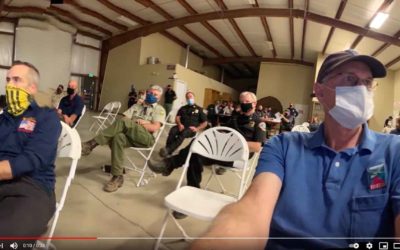
Sequoia Fire Team Briefing
SQF Team swap last night used our live aerial IR. A step-stare camera flying a NIROPS mission at 17500 transmitted live NADIR high-resolution LWIR & RGB and NIR on to the bottom of a big war-room screen and simultaneously showed AI fire polygons instantly as...
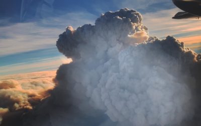
The Bear-North column from 27,000′
The Bear-North column from 27,000 ft before collapsing and turning the next day into night. The smoke was too thick for long wave infrared and fire growth was about 5 mph. In the morning we were called out of bed to go underneath and map. ATT/FirstNet beam form...
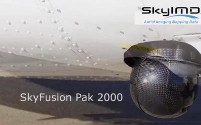
Mapping Streaming with a Gimbal
2019-2020 FIRIS program mapped Initial attack (IA) fires in SoCal within 5 minutes of aircraft arrival and every 15 minutes until released. Courtney Aviation’s mapped with Tase 200 Gimbal by using geolocated photos in google earth this method enabled the quick...